For the last couple of years cartographers and map-makers from around the world have taken part in a community-driven informal mapping event called the 30 Day Map Challenge. Created by Topi Tjukanov, it runs on Twitter with the simple idea that every day people upload a map based around the theme of the day. Adding the #30DayMapChallenge hashtag to the tweets provides a way of following along.
This year has seen a huge rise in people joining in and the level of creativity has been wonderful to see and follow. I decided to use the opportunity this year to retreat to my pens and pencils, and create sketch maps the evening before each day. It’s been a great way to just relax, and draw, with each map taking around 1-2 hours. Sometimes I’ve tried to inject some humour, or a play on words, and others have been more mainstream maps on the various topics.
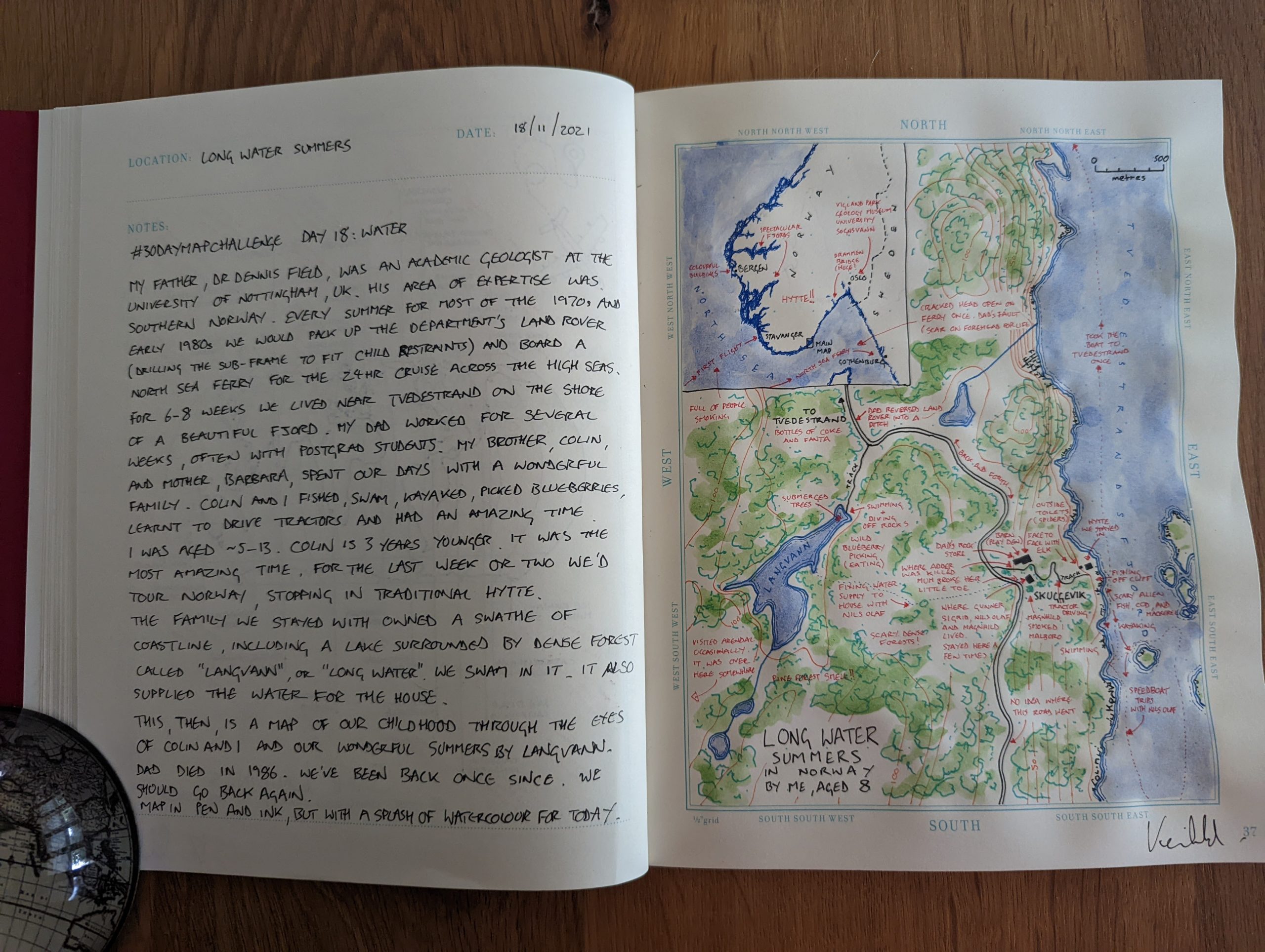
I got to the topic of ‘water’ this week, and while pondering various ideas my mind flipped back to childhood memories of summers in Norway spent with my family while my dad, an academic geologist, did his research on the geology of southern Norway. I recalled a lake called “Langvann” which we used to swim in almost daily, which translates simply as “Long Water” so I decided to sketch my childhood memories of the area that was home to me most summers growing up.
So, while I normally choose other people’s maps for my map of the week, this week was very personal to me, and the map stirred memories for my brother and I, as I asked him for his memories too. Here, then is “Long Water Summers” with accompanying notes.